Healey Dell Planning

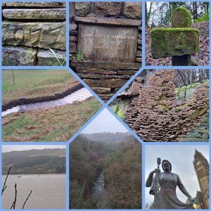
From Rochdale Town centre, passing the statue of Gracie Fields, the roads wound towards an abandoned asbestos factory, and here Panda and I skirted well wide of contaminated lands of Spotland. The so-called Spodden Valley asbestos controversy has scarred the 75-acre site. We didn’t go looking. Instead, we joined a sodden pathway along the River Spodden, heading toward Healey Dell.

Coupled with thoughts and a ball for throwing to make Panda chase, I hunkered down in the drizzling rain.I thought on how about in 2024, I must do something more human. Talk to the lonely. Comfort the desperate. Don’t be a knobhead. Think of others. Bless many, no matter their beliefs. Make the here and now matter. Improve tomorrow. Hug more. Push away negative people, paranoid eejits and fools. Surround yourself with passion, positivity, and vibes. Be kind. With the latter in mind, I threw the ball for Panda.

The river pathway crossed a road, with a higher path leading to a great viaduct, which I assume was once on the Rochdale to Bacup branch line. Passing over a rain-filled view, the bridge led to the old Whitworth station and the ruins of a stone rubbing mill. All soggy and damp. The pathway, more like a steam, carried on to the lower reaches of Whitworth village. Walking up Cown Park Way South, turning left on Tong End, the road led up to the Cown Reservoir.

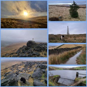
This sprawling waterlogged body of a reservoir sat beneath crags and a wide valley. Up the valley, north-east, would be the source of the Spodden. At Fairies Chapel, with a cave carved by a waterfall and apparently a fill desk and writing area. The weather didn’t allow a push on to that location. Instead, a loop of the reservoir and a perusal of James Treacle Sanderson‘s memorial. The champion runner lived from 1837-1905 and appeared to be a local character of note.

James Treacle Sanderson dashed up and down the 440 yards of the Eastern shore. Panda and I squelched along as I chatted to various dogwalkers, and Panda sniffed a bottom or ten. A custard slice, a Christmas gift from Dad, made a good snack. Panda ate some dog treats, and we motored back to Rochdale in driving rains. On returning to Healey Dell, we looked at the viaduct from beneath, with Panda leaving a message for other dogs. The Healey Dell heritage centre had long closed, and daylight vanished. We headed into Rochdale Town to catch a Metrolink tram back to Manchester. A good ten and a half miles of wandering (16.8km) albeit on an afternoon of pouring rain.

Windy Hill & Blackstone Edge

Turning right from Newhey Metrolink Tram station, a short ride from Manchester, Panda, and I walked beyond Bird In Hand and The Bird In The Hand signposted public houses of Newhey. We carried on until an old stone bridge and turned left off Huddersfield Road (A640) onto a cobble path parallel to Piethorne Brook. The Brook ran behind a campsite, industrial estate, and eventually a steep cobbled road swept up over Ogden Reservoir.

Ogden Reservoir, in the Piethorne Valley, sits at the lower end of a strong of water bodies. Our path climbed west and away from the giant puddles. Crossing the Brook west of Ogden Reservoir, up some steps and beyond abandoned building foundations, the path stretched upwards towards Tunshill Lane. This battered old farm track lined with rock, split off at 53.6164428, -2.0610034. Here, the road became abandoned, waterlogged, and an ideal testing point for waterproof footwear. The odd abandoned jeep carcas lay along the way, and long lost gate posts led to nowhere in particular. After a gentle ascent, Windy Hill Transmitter sat atop a top, 389 m (1,276 ft).

Banking left from the Transmitter, the Pennine Way Bridge with splayed leg carried the Pennine Way footpath towards Blackstone Edge (1549’/472m) and whisky cave. The low cloud, fierce hailstones, and torrential precipitation tested my face for feeling and hands for the ability to withstand harsh weather. Panda bounded around joyfully despite the brutal onslaught of uncomfortable weather. The gritstone boulders make for suitable shelter in thunderous winds. The Lancashire-Yorkshire border hosts great views of Manchester, although at times, dark clouds hid the growing skyscraper-lined skyline.

The Calder, Aire, and Ryburn have origins here. Each flow east to the North Sea. Similarly, Roch and Irwell have feeder streams here, destined for the Irish Sea. Having read bits afterwards, I recommend a spot of research before rambling and looking for diverse routes to the top. There are plenty of inspirations out there. I opted for the look at a Metrolink stop and study an Ordnance Survey map for interesting features, then get out and follow a map in my head. An inspection of the weather forecast may have been wise, too. The Craghoppers rain jacket I modelled did the job, though it was touch and go!

Once you’re up, you need to take in the views, snap a few shots, or, in my case, cling to a phone camera and pray the winds didn’t rip it from my hands. The hailstone became sleet and then sideways snow. Hands numbed fast. My face felt battered. An about turn and a descent, against altitude and fading light later, and Panda and I boarded an evening tram back to Manchester. Not a bad afternoon wander. 4 hours or so, all in. So, where next?